|
|
GeoAstro Applets |
Astronomy |
Chaos Game |
Java |
Miscel- laneous |
|
Azimuth and Elevation Applet More details: Sun Azimuth at Rise and Set Applet Applet: Azimuth, Latitude, Hour Angle, Declination
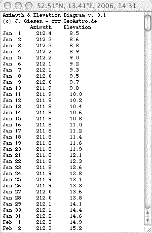
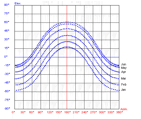
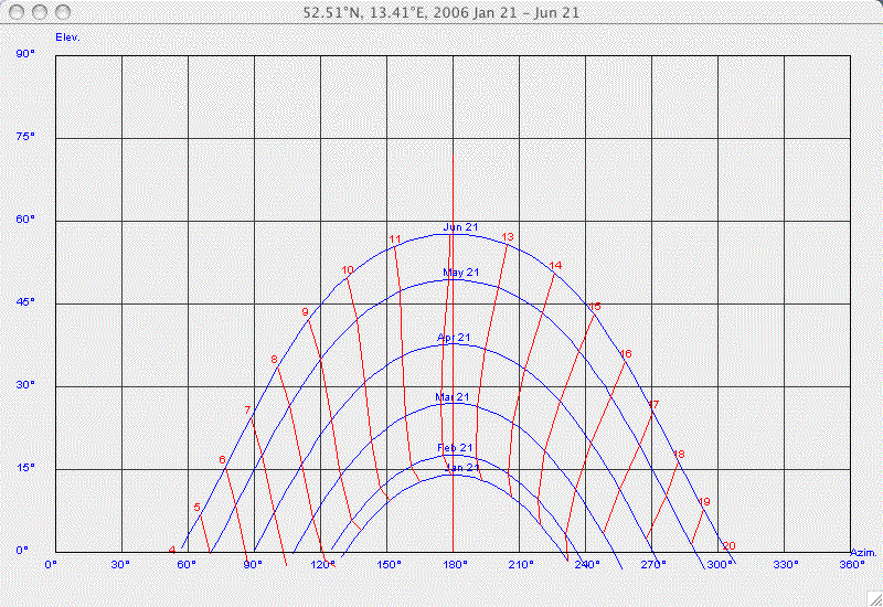
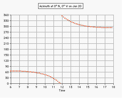
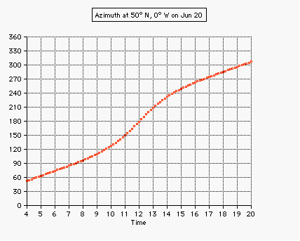
Diagrams of the elevation and the azimuth of the Sun for various latitudes and dates (exinoxes and solstices), generated by this applet Select your location from the menu list, or enter the coordinates (decimal degrees) for the latitude (southern negative), and for the longitude (western negative), then hit the button "Apply input": In the azimuth diagram the red part of the curve indicates that the sun is above horizon, in case of blue the sun has set:
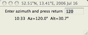
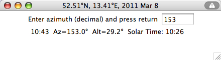
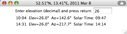
Get time of azimuth: Get times of elevation:
|
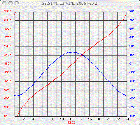
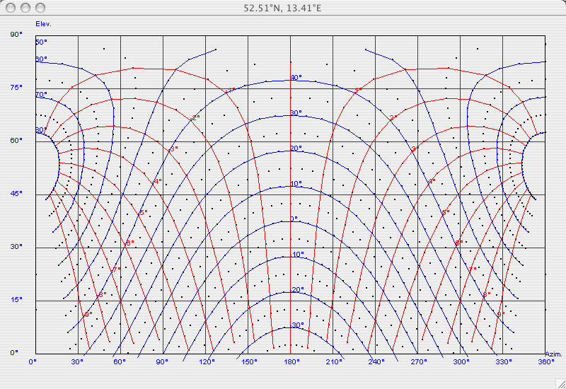
Choose AZ/ELEV Chart from the menu
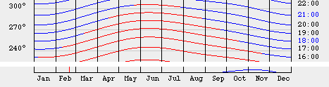
The
Graph
below helps estimate source rising and setting.
It is a plot of elevation vs. azimuth, with lines of constant
hour angle (red)
and declination (blue)
indicated. The lines of constant declinations are plotted in
increments of 10 degrees, while the lines of constant hour
angle are plotted in increments of 1 hour.
Example for 52.5°N:
Declination of the Sun 20°, sunrise (elevation 0°) is about 8 hours before noon at an azimuth angle of about 55°.
|
Choose Get Time from the menu to
compute the time
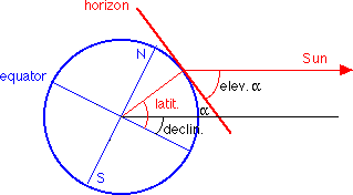
The azimuth and elevation angle are the coordinates of the
observer's local horizontal system: 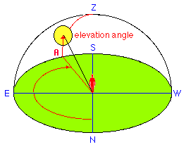 For a location of latitude beta the elevation angle of the sun at local noon is: where declin is the declination angle of the sun. Example: beta= 50° North delta=23.5° on June 21: delta=-23.5° on Dec. 21:
Last Modified: 2023 Oct 04
|