1. Go to the website of the U.S. Naval
Observatory: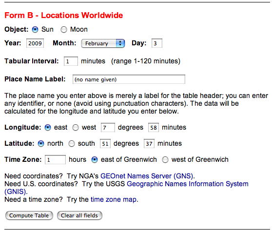 2. Print out the Altitude/Azimuth table for your latitude, longitude, timezone, and date at 1 minute time intervals. 3. Find the time of local noon, i. e. the time when the azimuth angle is next to 180° (northern latitude), or next to 0° (southern latitude). 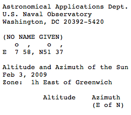 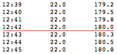 4. Place the disk on the Sun Compass, the index line pointing to 0° of the "DEGREES" scale, and fix it. 5. Read the azimuth angle for local noon time minus 1 hour. 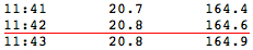 6. Calculate the positive difference of
azimuth from
180° (northern latitude), or from 0° (southern latitude).
180° -
164.6° = 15.4°
7. Mark the
corresponding shadow angle on the "DEGREES" scale, using the ruler.
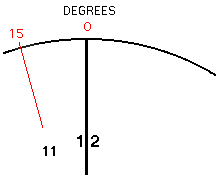 8. Repeat with local noon minus 2 hours , minus 3 hours, and so on. 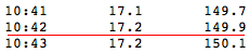 180° - 149.9° = 30.1° 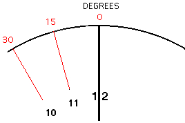 9. Using Local Apparent Time the shadow angle is the same for equal time distances before and after noon but on opposite sides of the index line. 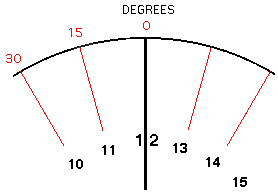 |
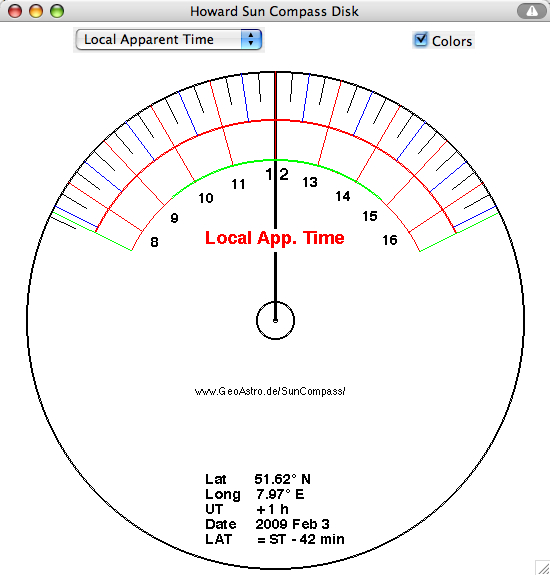
The result using my applet: